Our services
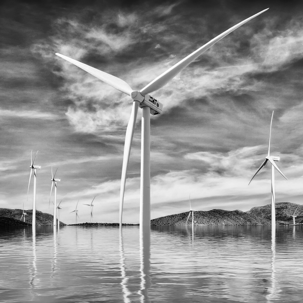
Inspections
Keeping renewable energy facilities running smoothly is crucial. Our drones can inspect turbines and panels quickly and comprehensively, helping you identify and address issues before they become costly problems.
Consulting and R&D
We believe that innovation is the fuel for progress. We know the world isn’t ready for ordinary, and neither are we. With our Consulting and R&D services, you can stay ahead, driving efficiency, improving safety, and unlocking possibilities that were once beyond reach.

Surveillance
Security is paramount in today’s world. Our surveillance drone services offer real-time monitoring and data analysis, enhancing your security measures and providing valuable insights into your operations.
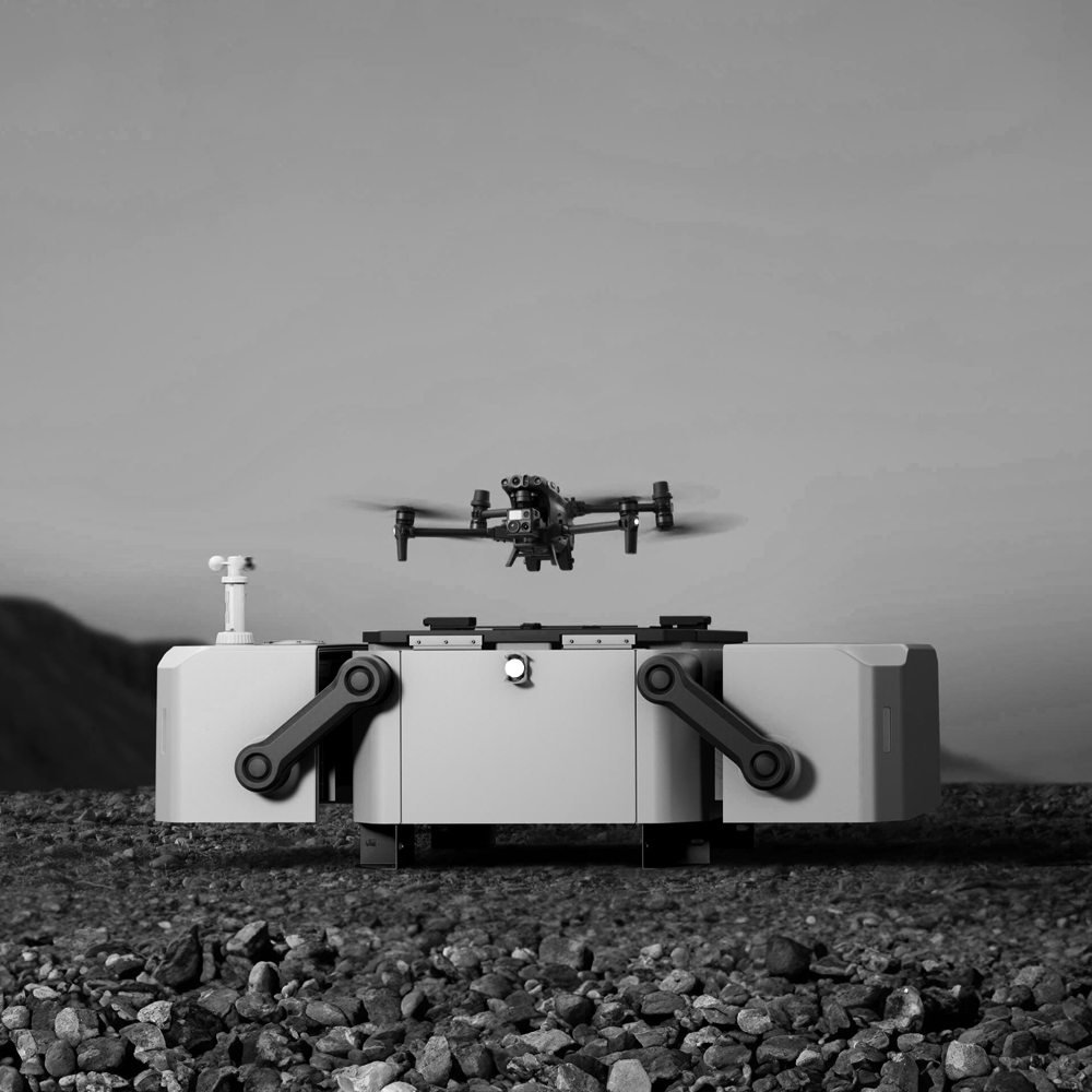
Drones
As a subsidiary of Abero Technologies, Starsview benefits from a strong foundation of expertise and a vast network. Abero Technologies, our parent company, is a renowned leader in technology solutions, including a reseller of top-quality drones.
Check out these shops:
Other services
Public Safety and Emergency Response
Drones are increasingly utilized by public safety agencies and emergency responders for search and rescue missions, disaster assessment, and situational awareness. In this category, your services would involve supporting first responders with real-time aerial data, thermal imaging, and mapping during emergencies, helping save lives and mitigate risks.
Cinematics
Our Cinematics division in partnership with Flickorna Productions takes storytelling to new heights, literally. We specialize in capturing breathtaking aerial footage that transforms your vision into cinematic reality. Whether it’s for film, advertising, or documentary projects, we provide the creative flair and technical expertise to make every shot a masterpiece.
Mapping and Surveying
This category includes services related to aerial mapping, land surveying, and topographical analysis. Drones equipped with high-resolution cameras and LiDAR technology can capture accurate data for mapping purposes. This can be valuable in various industries, including construction, agriculture, and land development.
Infrastructure and Asset Management
Whether it’s bridges, roads, or buildings, our drones are ideal for assessing the condition of critical infrastructure. We provide detailed reports that help you plan maintenance and repairs with precision.
Using drones for inspecting and managing critical infrastructure such as bridges, pipelines, power lines, and industrial facilities. Drones equipped with specialized sensors can detect structural issues, perform asset inventory, and facilitate predictive maintenance, ensuring the longevity and safety of infrastructure assets.